Tourism of Uttaranchal | Uttaranchal Tourism

Tourism of Uttaranchal | Uttaranchal Tourism
Uttarakhand formerly Uttaranchal, is a state located in the northern part of India. It is often referred to as the Land of Gods due to the many holy Hindu temples and cities found throughout the state which are some of Hinduism's most spiritual and auspicious places of pilgrimage and worship. Known for its natural beauty, it was carved out of Himalayan and adjoining districts of Uttar Pradesh on 9 November 2000, becoming the 27th state of the Republic of India. It borders the Tibet Autonomous Region on the north, Nepal on the east and the Indian states of Uttar Pradesh to the south, Haryana to the west and Himachal Pradesh to the north west.

The region is traditionally referred to as Uttarakhand in Hindu scriptures and old literature, a term which derives from Sanskrit uttara meaning north, and khand meaning country or part of a country. It has an area of 20,682 sq mi (53,566 km²).

In January 2007, the name of the state was officially changed from Uttaranchal, its interim name, to Uttarakhand. The provisional capital of Uttarakhand is Dehradun which is also a rail-head and the largest city in the region. The small hamlet of Gairsain has been mooted as the future capital owing to its geographic centrality but controversies and lack of resources have led Dehradun to remain provisional capital. The High Court of the state is in Nainital.

Recent developments in the region include initiatives by the state government to capitalise on handloom and handicrafts, the burgeoning tourist trade as well as tax incentives to lure high-tech industry to the state. The state also has big-dam projects, controversial and often criticised in India, such as the very large Tehri dam on the Bhagirathi-Bhilangana rivers, conceived in 1953 and about to reach completion. Uttarakhand is also well known as the birthplace of the Chipko environmental movement, and a myriad other social movements including the mass agitation in the 1990s that led to its formation.

Geography of Uttarakhand:


Uttarakhand has a total geographic area of 51,125 km², of which 93% is mountainous and 64% is covered by forest. Most of the northern parts of the state are part of Greater Himalaya ranges, covered by the high Himalayan peaks and glaciers, while the lower foothills were densely forested till denuded by the British log merchants and later, after independence, by forest contractors. Recent efforts in reforestation, however, have been successful in restoring the situation to some extent. The unique Himalayan ecosystem plays host to a large number of animals (including bharal, snow leopards, leopards and tigers), plants and rare herbs. Two of India's mightiest rivers, the Ganges and the Yamuna take birth in the glaciers of Uttarakhand, and are fed by myriad lakes, glacial melts and streams in the region.

Uttarakhand lies on the southern slope of the Himalaya range, and the climate and vegetation vary greatly with elevation, from glaciers at the highest elevations to subtropical forests at the lower elevations. The highest elevations are covered by ice and bare rock. Below them, between 3,000 and 5,000 metres (9,800 and 16,000 ft) are montane grasslands and shrublands:

the western Himalayan alpine shrub and meadows. Temperate coniferous forests, the western Himalayan subalpine conifer forests, grow just below the tree line. At 3,000 to 2,600 metres (9,800 to 8,500 ft) elevation they transition to the temperate western Himalayan broadleaf forests, which lie in a belt from 2,600 to 1,500 metres (8,500 to 4,900 ft) elevation.

Below 1,500 metres (4,900 ft) elevation lie the Himalayan subtropical pine forests. The Upper Gangetic Plains moist deciduous forests and the drier Terai-Duar savanna and grasslands cover the lowlands along the Uttar Pradesh border. This belt is locally known as Bhabhar. These lowland forests have mostly been cleared for agriculture, but a few pockets remain.

Indian National Parks in Uttarakhand include the Jim Corbett National Park (the oldest national park of India) at Ramnagar in Nainital District, Valley of Flowers National Park and Nanda Devi National Park in Chamoli District, which together are a UNESCO World Heritage Site, Rajaji National Park in Haridwar District, and Govind Pashu Vihar National Park and Gangotri National Park in Uttarkashi District.

Districts of Uttarakhand:


There are 13 districts in Uttarakhand which are grouped into two divisions. Kumaon division and Garhwal division:

The Kumaon division includes six districts.


Almora
Bageshwar
Champawat
Nainital
Pithoragarh
Udham Singh Nagar

The Garhwal division includes seven districts.


Dehradun
Haridwar
Tehri Garhwal
Uttarkashi
Chamoli
Pauri Garhwal (commonly known as Garhwal)
Rudraprayag

Important cities in Uttranchal:


City District

Dehradun Dehradun
Haridwar Haridwar
Haldwani Nainital
Roorkee Haridwar
Kashipur Udham Singh Nagar
Rudrapur Udham Singh Nagar
Rishikesh Dehradun
Pithoragarh Pithoragrah
Ramnagar Nainital
Nainital Nainital
Almora Almora
Mussoorie Dehradun
Kotdwara Pauri Garhwal
Srinagar Pauri Garhwal
Gopeshwar Chamoli
Ranikhet Almora
Uttarkashi Uttarkashi
Tanakpur Champawat
Khatima Udham Singh Nagar
Vikasnagar Dehradun
Bageshwar Bageshwar
Banbasa Champawat
Karanprayag Chamoli
Champawat Champawat
Rudraprayag Rudraprayag
Devprayag Pauri Garhwal

Flora and Fauna of Uttaranchal:


Wildlife Reserves and National Parks:


Assan Barrage:


The Assan barrage is a wetland in the Uttarakhand-Himachal Pradesh border region in Doon Valley, (Dehradun District), northern India, situated at the confluence of the Yamuna Canal and the Assan River and about 11 kilometers from Dak Pathar, and 28 km. southwest of Dehradun.

Askot Musk Deer Sanctuary:


Askot Musk Deer Sanctuary is located 54 km from Pithoragarh near Askot in Uttarakhand state of India, nestles at a height of 5412 ft (1650 m). This sanctuary has been set up primarily with the object of conserving the musk deer (Moschus moschiferus) and its habitat. Intensive efforts have been initiated to conserve this rare species. Other mammals found in this sanctuary include the leopard, jungle cat, civet cat, barking deer, serow, goral and brown bear. Many species of high altitude birds are also found in this sanctuary.

Jim Corbett National Park:


Jim Corbett National Park is India's oldest national park, and located near Nainital in the state of Uttaranchal. The park is known for its varied wildlife, and as the site for the launching of Project Tiger. The Corbett National Park and the adjoining Sonanadi Sanctuary form the Corbett Tiger Reserve.

The park was first established on August 8, 1936 as Hailey National Park under the United Provinces National Parks Act of India (after Sir Malcolm Hailey, the then Governor of the United Provinces.) In 1952, five years after India attained independence, the park was renamed Ramganga National Park, after the Ramganga river that flows through most of its length. In 1957, it was again renamed, Corbett National Park, in honour of Jim Corbett, a legendary hunter-turned-conservationist, best known for hunting man-eating tigers and leopards in the Kumaon and lower Garhwal in the 1920s, and for later chronicling his adventures in many books, like The Maneaters of Kumaon and The Maneating Leopard of Rudraprayag, that were bestsellers around the world.

The wildlife found in the Corbett National Park include the tiger, elephant, chital, sambar, nilgai, gharial, King Cobra, muntjac, wild boar, hedgehog, common musk shrew, flying fox, Indian Pangolin, and nearly 600 species of birds. The park receives thousands of visitors every year. A variety of facilities are available to house tourists within and outside the park.

Govind Wildlife Sanctury:


The Govind Wildlife Sanctuary, situated in the Uttarkashi district of Uttararanchal, was established on 1st March, 1955. It spreads over an area of 957.969 sq. kms. and the altitude varies from 1300 mts. to 6323 mts. The average annual precipitation varies from 1000 to 1500 mm., most of which occurs as monsoon rains (July to Sept.). The entire area of the sanctuary is subjected to light to heavy snowfall. The sanctuary forms the upper catchment of the Tons river, which is the most important tributory of River Yamuna in its upper reaches. Thus the area has a significant value as a major watershed for River Yamuna, which is a very important river for the Indo Gangetic plains. The area is home for a lot of endangered animals and its large area along with the contiguous forests of the neighbouring forest divisions helps in maintaining genetic diversity. The area is very rich in medicinal plants, many of which form the basis for certain life saving drugs. The scenic beauty of the area is unmatched. The Snow Leopard inhabits the inner Himalayas above the altitude of 3500 mts. With the onslaught on the habitat by man its number has dwindled considerably making it a highly endangered species. In the Eighth Plan, the Govt. of India

launched the Snow Leopard Project for the long term conservation of this elusive cat. An expert team indentified sites throughout the Himalayas to implement this project and Govind Wildlife Sanctuary was indentified as one of such sites. To further improve the protection of this rare animal, the upper reaches (the Snow Leopard habitat) of the sanctuary were intentionally notified as a National Park, which covers an area of 472.08 sq. kms.

Nanda Devi National Park:


The Nanda Devi National Park is a national park situated around the peak of Nanda Devi, 7,817 m (25,646 ft), in the state of Uttarakhand in northern India. It was established as national park in 1982 and was inscribed a World Heritage Site by UNESCO in 1988. It covers 630.33 km².

The park encompasses the Nanda Devi Sanctuary, a glacial basin surrounded by a ring of peaks between 6,000 metres (19,700 ft) and 7,500 m (24,600 ft) high, and drained by the Rishi Ganga through the Rishi Ganga Gorge, a steep, almost impassable defile. Together with the nearby Valley of Flowers National Park to the northwest, it is a designated World Heritage Site.

Both parks are encompassed in the Nanda Devi Biosphere Reserve (223,674 ha) which is further surrounded by a buffer zone (5,148.57 km²).

The entire park lies at an elevation of more than 3,500 m (11,500 ft) above mean sea level.

Rajaji National Park:


Rajaji Park, which has several gates, is accessible from Dehradun, Kotdwar and Haridwar: the Ramgarh Gate and Mohand Gate are within 25 km of Dehradun; the Motichur, Ranipur and Chilla Gates are about 9 km from Haridwar; Kunao Gate is 6 km from Rishikesh; and Laldhang gate is 25 km from Kotdwar. Saharanpur, which is conveniently linked by train to other parts of India, is another attractive point to reach the Mohand area of the Park, in nearly an hour by road.

Rajaji National Park is an Indian national park that encompasses the Shivaliks, near the foothills of the Himalayas. It is spread over 820 km², and three districts of Uttarakhand: Haridwar, Dehradun and Pauri Garhwal. In 1983, three wildlife sanctuaries in the area namely, Chilla, Motichur and Rajaji sanctuaries were merged into one Rajaji National Park has been named after C. Rajagopalachari (Rajaji), a prominent leader of the Freedom Struggle, the second and last Governor-General of independent India and one of the first recipients of India's highest civilian award Bharat Ratna (in 1954).

Valley of Flowers National Park:


Valley of Flowers National Park is an Indian national park, Nestled high in West Himalaya, is renowned for its meadows of endemic alpine flowers and outstanding natural beauty. It is located in Uttarakhand state. This richly diverse area is also home to rare and endangered animals, including the Asiatic black bear, snow leopard, brown bear and blue sheep. The gentle landscape of the Valley of Flowers National Park complements the rugged mountain wilderness of Nanda Devi National Park.

Together they encompass a unique transition zone between the mountain ranges of the Zanskar and Great Himalaya. The park stretches over an expanse of 87.50 km².

The Valley of Flowers is an outstandingly beautiful high-altitude Himalayan valley that has been acknowledged as such by renowned mountaineers and botanists in literature for over a century and in Hindu mythology for much longer. Its ‘gentle’ landscape, breathtakingly beautiful meadows of alpine flowers and ease of access complement the rugged, mountain wilderness for which the inner basin of Nanda Devi National Park is renowned.

Valley of flower is splashed with colour as it bloomed with hundreds different beautiful flowers, taking on various shades of colours as time progressed. Valley was declared a national park in 1982, and now it is a World Heritage Site. The locals, of course, always knew of the existence of the valley, and believed that it was inhabited by fairies.

While trekking towards valley of flowers, one can experience the beauty of shining peaks fully covered with snow. One can also see the beautiful view of surrounding greenery and various running streams with crystal clear water.

The valley is home to many celebrated flowers like the Brahmakamal, the Blue Poppy and the Cobra Lily. It is a much sought after haunt for flower-lovers, botanists and of course trekkers, for whom a sufficient excuse to embark on a mission to reach a place, is that it exists.

Trekking Routes of Uttarakhand :


  • Devaria Tal Tungnath Chandershila Trek
  • Gangotri Bhoj Kharak Kedar Tal Trek
  • Gaumukh Nandanvan Tapovan Trek
  • Lahajunng Badni Roopkund Trek
  • Uttarkashi Kalyani DidiTal Trek
  • Valley Of Flower Hemkund Trek
  • Kedarnath and Vasuki Tal Trek
  • Dodi Tal and Daebatop Trek
  • Khatling Glacier Trek
  • Pindari Glacier Trek
  • Har Ki Dun Trek
  • Milam Glacier Trek
  • Pawali Kantha Trek
  • Kafni Glacier Trek
  • Nandi Kund Trek
  • Mayali Pass Trek
  • Kagbhusandi Tal Trek
  • Sahastra Tal Trek
  • Masar Tal Trek
  • Painya Tal Trek

Hill Stations in Uttarakhand / Uttaranchal:

Mussoorie:


Mussoorie with its green hills and varied Flora and Fauna, is a fascinating hill resort. Commanding a wonderful view of extensive Himalaya snow ranges to the northeast, and glittering views of the Doon Valley, Roorki, Saharabpur and Haridwar to the south, the town presents a fairy land atmosphere to the tourists. Its history back to 1827 when Captain Young, an adventures military officer, explore the present site and laid the foundation of this holiday resort which now has few rivals. Mussoorie is famous for its scenic beauty and hectic social life. It provides all kind of amusement and every facility for domestic and foreign tourist. Mussoorie is conveniently connected by road to Delhi and by other major Cities and is also a "Gateway" to Yamunotri and Gangotri shrines.

Khirsu:


The snow - laden mountains of Khirsu tempt the tourist in winters, while the panoramic view of Central Himalayas attracts tourists in summers, when one can get a clear view of 300 named and unnamed peaks. Located 19 kms. away from Pauri at an altitude of 1700 mts. Khirsu is a peaceful spot free from pollution. The tranquility of the adjoining thick Oak and Deodar forests and apple orchards, is only broken by chirping birds. The ancient temple of Ghandiyal Devta in the vicinity is well worth a visit.

Nainital:


The Nainital tourist district is the pride of the Kumaon region in Uttaranchal. While there are many other places equally beautiful, Nainital is certainly the most popular tourist destination in Kumaon. It's a pleasant hill station. For tourists looking for hustle and bustle the best time to go is the summer months when a lot of traffic ascends from Delhi and the plains.

Pauri:


Situated at an elevation of 1814 mts. above sea - level on the northern slopes of Kandoliya hills, Pauri is headquarter of the district Pauri Garhwal and Garhwal Division.

Pauri provides a panoramic view of the snow clad Himalayan peak of Bandar Poonch, Swarga Rohini, Jonli, Gangotri Group, Jogin Group Thalaiya - Sagar, Kedarnath, Kharcha Kund, Sumeru, Satopanth, Chaukhamba, Neelkanth, Ghauriparvat, Hathiparvat, Nanda Devi and Trisul.

Srinagar:


Srinagar abounds in ancient temples and Kamleshwar is the most prominent among them. It is said that Lord Rama had worshipped Lord Shiva here with a thousand lotus flowers. One flower fell short and Rama compensated this loss by offering one of his eyes. That is the reason why he is also known as 'Kamal Nayan', meaning lotus eyed. Every year on the occasion of 'Vaikunth Chaturdashi', women come here to worship Lord Shiva whole night with lighted lamps.

Almora:


The ancient town of Almora, before it's establishment was under the possession of Katyuri king Baichaldeo. He donated major part of this land to a Gujrati Brahmin Sri Chand Tiwari. Later on when Chand kingdom was founded in Baramandal, the town of Almora was founded at this centrally located place in 1560 by Kalyan Chand.

Joshimath:


Adi Guru Sankaracharya, who came all the way from Kerala in the 8th century A.D., performed penance under a tree and after attaining enlightenment, established a Math, (religious center), known as 'Jyotirmath.

The name Joshimath is derived from it. Temples of Narsingh Dev and Nav Durga is located here. Of special scenic interest are orchards of apple, apricots, lemons and maltas spread all over. Badrinath is just 44 km. from here. Joshimath is also Gatway of Badrinath.

Kausani:


At the hill resort of Kausani the mountains rise so dramatically as if to reach the heavens. In fact not just Kausani the entire Kumaon Hills have been known for their idyllic beauty with the huge mountains silhouetted against the sky. Kausani was originally called Valna. Kausani offers the magic of the deep pine forests and the majestic mountains.

Haridwar:


Located in the foothills of Shivalik range, Haridwar is reputed as the gateway to the four pilgrimages in the Uttaranchal region. Visit this sacred place that will purify your body, mind and the soul. Spend some time on the ghats in Haridwar that acquire a unique charm in the evening with countless diyas floating in the waters of Ganges. Down the ages Haridwar has also become a major learning center for science, arts and culture.

Rishikesh:


Rishikesh is one of the most popular pilgrim centres and gateway to the Himalayan Shrines of Badrinath, Kedarnath, Gangotri and Yamunotri. The Yoga Centres of Rishikesh have enhanced the significance of the place. From this point on, the great Ganges leaves behind her mountain home and enters the vast plains of Northern India.

Auli:


Auli is nestled in the lap of snow-capped peaks of the Garhwal Himalayas, in the Chamoli district of Uttaranchal india, and near the world-famous religious shrine of Badrinath. At an altitude of 2,500 to 3,050 meters above sea level, Auli’s well-dressed slopes are flanked by coniferous and oak forests, which offer a panoramic view of Mountains If you are out for adventure, fun and frolic this winter, find yourself in Auli, in the vicinity of the mountain peaks Nanda Devi and Mana Parbat.

Feel the rush of air on your face, blaze a defiant trail as you go skiing on the well-dressed snow slopes. Or pelt each other with snow-balls on a blanket of snow. And if you’re a lover of natural splendour let your eyes feast on the breathtaking view of snow-capped peaks all around you. A16 km from Joshimath and accessible by a good motorable road, is the ideal ski resort of Auli with its slopes comparable to the best in the world. The resort is run by GMVN, which, apart from providing accommodation also provides all facilities for skiing. The season extends from January to March during which time skiing festivals and the National Championships are held. he Auli slopes, descending from 3049 meters to 2915 meters are flanked by stately conifers and oaks, which cut wind velocity to the minimum. Adding to the thrill of skiing is a 180 degree view of Himalayan peaks,which include Nanda Devi (7817 meters), Kamet (7756 meters), Mana Parvat (7273 meters) and Dunagiri (7066 meters), seemingly only a snowballs throw away.

Dehradun:


Nestled in the mountain ranges of the Himalaya, Dehradun is the Capital of Uttaranchal. It is one of the most beautiful resort in the submountain tracks of India, known for its scenic surroundings. The name Dehradun is a collection of two word "dera" meaning Camp and " dun" meaning valley Said to be one of the oldest citites in India, it is believed that lord Rama and his brother did penance here for killing Ravana, the demon king. During the 17th and 18th centuries Dehradun changed hands several times: Guru Ram Rai retreated here from Punjab, the Mughal Governor Najib-ud- Daula occupied it from 1757-1770 and the Gorkhas overran it on their westward expansion before ceding it to the British in 1815. Under the British, Dehradun became an elite town with many a fine institution like Forest Research Institute, Doon and Welham Schools, Many more, like the ONGC and Wadia Institute of Himalayan Studies, were added in time. Dehradun has now become an important tourist destination

Badrinath and Kedarnath:


The temples of Shiva and Vishnu at Kedarnath and Badrinath have been the destination of pilgrims for centuries. The route to the two sources begins at Rishikesh and passes ancient temples and Valleys along the way. Badrinath is one of the four Dhams; a devout Hindu has to visit in his lifetime to attain salvation. One of Hinduism's holiest sites, it was founded by Sri Shankaracharya, in the ninth century. The temple, also known as Badri Narayan, is dedicated to Vishnu, who is said to have done penance in the mythical Brindavan that once covered the mountains of Uttarakhand.

Kedarnath:


Kedarnath is the most important Hindu shrine in Himalayas, and among the major Shiva temples, of the country. Located at the source of the river Mandakini, Kedarnath is one of the twelve Jyothirlingas, of Lord Shiva, and one of the Panch Kedars.

Mythology identifies the deity at Kedarnath temple, with the rump of a bull, a form assumed by Lord Shiva, when eluding the Pandavas, who had come for repentance for killing their kith and kin, in the great battle of Kurukshetra. It is believed that the Pandavas constructed the temple of Kedarnath.

Gangotri:


In the hinterlands of the Himalayas is Gangotri where, it is believed, Ganga, the stream of life, touched earth for the first time. According to the Hindu religious scriptures, the goddess manifested herself in the form of a river to absolve the sins of King Bhagirathi's sons, following his penance of several centuries. The Goddess Ganga is worshipped by the devout as a deity. The Gangotri temple was built in the early 18th century by a Gorkha commander, Amar Singh Thapa and later rebuilt by the Maharaja of Jaipur.

Yamunotri:


Yamunotri, the source of the river Yamuna, is the westernmost shrine in the Garhwal Himalayas, located on a flank of the Bandarpunch peak. The trek along the riverbank is quite magnificent, dominated by a wide panorama of mountains.

Haridwar :


Haridwar, on the right bank of River Ganga at the feet of Shivalik ranges, an ancient pilgrim city is one of the holiest places for Hindus. Haridwar is at the point where the river Ganga spreads over the northern plain. It lies at the base of the Shivalik Hills where the Ganga passes through its last gorge and begins a 2000 km journey across the plains. One of the four venues for the Kumbh Mela, a festival held once in twelve years, it is among the seven sacred cities of India. A holy dip at Har-Ki-Pauri is a must for every devotee.

Rishikesh :


Rishikesh is one of the most popular pilgrim centres and gateway to the Himalayan shrines of Badrinath, Kedarnath, Gangotri, & Yamunotri. The Yoga centres of Rishikesh have enhanced the significance of the place. Legend has it that the sage Raibhya Rishi did severe penance and, as a reward, God appeared to him in the form of Rishikesh. Rishikesh also represents the site where Lord Vishnu vanquished the demon Madhu. The place is known as the Tapo Bhumi or the place for meditation of the Gods.

In the 1960s, the place came into limelight as the place where the pop group Beatles met their guru, Maharishi Mahesh Yogi.

Nainital :


Dotted with lakes, Nainital has earned the epithet of 'Lake District' of India. Nainital’s unending expense of scenic beauty is nothing short of a romance with awe-inspiring and pristine Mother Nature.

Ranikhet:


How to reach at Ranikhet:


A large network of road and rail connects Ranikhet to all parts of India. It is an eight hours drive from Delhi via Moradabad and Haldwani. A convenient daily overnight air-conditioned train - " Ranikhet Express" connects Delhi to the railhead Kathgodam. Besides innumerous bus services, both air-conditioned and non air-conditioned, are available from Scindia House, New Delhi and Anand Vihar Bus Terminal, Delhi.

Air:

Nearest Airport is Pantnagar, 112 Kms, but flights are not operational at present

Rail:

Nearest Railway heads are Kathgodam - 80 Km. & Ramnagar 96 Km.

Road:

Ranikhet is well connected by roads to important centers in the reigion. Some of the major distances are : Almora (49 km.),Delhi (386 km.), Nainital (59 km.), Kathgodam (80 km)

A quaint little hill station conceived by the British tucked away in the Kumaon (uttaranchal India) Himalayas. An old army cantonment from British time. Charmingly unspoilt natural beauty…. Screen and quiet. This is Ranikhet.

Discovered by Lord Mayo in 1869 and developed as a cantonment for the Imperial Soldiers, Ranikhet is perched at an altitude of 1829 meters. Even today it boasts as the home of the Kumaon regiment. Here, time stands still.

General Information of Ranikhet:


Area:

21.76 sq. km.

Population:

18174 (1991 census)

Altitude:

1829 mtrs. Above sea level.

Season:

April to June, September to October

Clothing:

Summer - Light Woolens ; Winter - Woolens

Language:

Hindi, Kumaoni and English

Local Transport:

Taxis/Jeeps/Buses

STD Code:

05966

Perched admist "Dev Bhumi" a visit to the numerous ancient temples built from the 6th to 12th century sets the tone of love, peace, contentment and happiness

Ranikhet is the apex of a triangle which includes Nainital and Almora, driving along gentle slopes and pine covered hillsides, leading to picnic spots in shady glens or to sheer cliffs with breath taking views of the snow covered Himalayas, offering various moods and colours, from the misty morning sun to pink, gold and cobalt blue in all their majestic glory. The unparalled view from Bazaar, one Kilometer long, is absolutely nostalgic. Here, natural beauty is intermingled with a flavor of history…

Excursion of Ranikhet:


The more adventurous can descend on a whole lot of day excursions:

Binsar Mahadev 14 kms
Dwarahat 35 kms
Sitlakhet 30 kms
Almora 45 kms
Binsar 60 kms
Kausani 75 kms
Jim Corbett Park 90 kms

Chaubatia :


10kms. away and popularly known as orchard country, commands a picturesque view of the Himalayas.

Bhaludam :


3kms. from Chaubatia, known for its artificial lake and picnic spots.

Upat and Kalika :


5kms. from Ranikhet, on the main road to Almora is one of the best 9-hole golf courses in the area and is surrounded by lush pine forests. The Kali temple and a forest nursery nearby are worth visiting. It could be an ideal location for film shooting.

Majkhali :


13kms. from, Ranikhet, on the way to Almora, Majkhali offers a close view of the snowy heights.

Chaukhutia :


Chaukhutia is famous for its natural beauty and fishing centre. It is about 54kms enroute to Badrinath.

Manila :


Manila ( meaning enchanting ) is 87kms. from Ranikhet & 75kms. from Ramnagar. Manila is the seat of Manila Devi - the family Goddess of the Katyuri clan. The forest and the Himalayan view from this hill is enchanting.

Jaurasi :


6000ft., above sea level, 16kms. from Chaukhutia, Jaurasi is famous for its panoramic view.

Khairna :


22kms. from Ranikhet on the Nanital route, it is famous for fishing.

Pilgrimage of Uttaranchal / Uttarakhand:


Garhwal Pilgrimage:


Char Dham Yatra:


Uttarakhand enrich by four most holy pilgrimages of India – Yamunotri, Gangotri, Kedarnath & Badrinath, collectively referred as to as the Char Dham.

Badri - Kedar Yatra
Gangotri-Yamnotri Yatra
Panch Badri Yatra
Pancha Kedar Yatra
Pancha Prayag Yatra

Kumaon Pilgrimage:


Adi Kailash Yatra
Patal Bhuvneshar Yatra
Jageshwar Mahadev
Binsar Mahadev
Mukteshwar Yatra
Jageshwar & Binsar

Adventure Activity in Uttaranchal / Uttarakhand:


River Rafting in Garhwal and Kumoan:


Half Day Float trip from Brahmpuri to Muni Ki Reti (11 Kms) Best For Children between 5 to 10 years , Families with children & elderly people Inclusive of Transport to Starting point, Tea/ Soft drinks, Rafting with professional river guide and world class equipment.

Drive(20 Minutes) to Brahmpuri. Arrive and walk down to the river. After preparation and safety briefing enboat to raft down till Muni ki Reti. We hit Initiation, Double Trouble , Hilton and terminator rapids. One can try body surfing & cliff jump on this section. In the later part we float past Suspension bridges, ashrams and temples. Certainly the best angle to see Rishikesh the town of Gods ,Ghats & the Ganges. Trip terminates upon arrival at Muni Ki Reti.

We are a team of 25 young professionals including experienced trekking and river guides, cooks and other camp staff, our own Guest House at Tapovan, Rishikesh, River/ beach camp at Brahmpuri, Nature camp at Shivpuri, with “A” Class trekking and rafting equipment, and fleet of brand new vehicles etc.We have adventure specialization in india

Skiing in Garhwal:


The hills of Uttaranchal india have all the ingredients for adventure packed with excitement and thrills - an unexplored valley, towering peaks, flowing rivers, snow-capped mountains, a splendid combination of flora & fauna and vast tracts of virgin snow. The region also rovides immense opportunities for adventure sports like skiing, water sports and Aero sports which make Garhwal an ideal venue for adventure seekers. amongst the glaciers. For the avid skier, cross-country runs of 10-20 kms. are now available, with the added advantage of fresh powder snow, away from criss-crossing streams of skiers that over. The large slopes of Garhwal covered with seasonal snow became an ideal place for skiing in the winter months. With their wide open spaces above the snowline, Garhwal offer yet another exciting possibility - ski touringtake the slopes of the European Alps. Because of their height and spread, Garhwal, like other sectors of the Himalayas, are in position to offer the thrills of exploratory long distance skiing round the year.

Auli 16 kms. from Joshimath is an ideal winter resort run by Garhwal Mandal Vikas Nigam (GMVN). A 3 kms. long slope ranging from a height of 2519 mts. to 3049 mts. is a major attraction. The Auli resort run by GMVN has snow beaters which beat the snow to keep the slopes fit for skiing at all times. A 500 mts.long ski-lift carries skiiers back to the slope

Trekking in Garhwal:

Trekking in Kumoan:

Jeep Safari in Kumoan:

Biking in Garhwal:

Biking in Kumoan:

Camping in Garhwal:

Camping in Kumoan:

Rock Climbing:


Hotels in Uttaranchal / Uttarakhand


  • Monal Resort, Rudraprayag
  • Balrampur House, Nainital
  • Hotel Madhuban, Dehradun
  • Ananda in the Himalayas
  • Chevron Mount Vila
  • Camp Forktail Creek
  • Kasmanda Palace, Mussoorie
  • Chardham Camp
  • Chevron Rosemount
  • Club Mahindra Resort
  • Hotel Midtown, Haridwar
  • Hotel Neelkanth, Haridwar
  • Hotel Pramila, Haridwar
  • Hotel Shiva, Haridwar
  • Hotel Suryodaya, Haridwar
  • Janhvi Dale, Haridwar
  • Camp Forktail Creek, Corbett
  • Claridges Corbett Hideaway, Corbett
  • Corbett Ramganga Resort, Corbett
  • Corbett Riverside Resort, Corbett
  • Infinity Resort, Corbett
  • Quality Inn Corbett Jungle Resort, Corbett
  • Solluna Resort, Corbett
  • Tiger Camp, Corbett
  • Hotel Narayan Palace, Badrinath
  • Shervani Hill Top Inn, Nainital
  • Manu Maharani Resort , Nainital
  • The Naini Retreat Nainital
  • Vikram Vintage Inn , Nainital
  • Hotel Arif Castles, Nainital
  • Pine Crest Nainital
  • Grand Hotel Nainital
  • Dynasty Resort Nainital
  • Hotel Everest Nainital
  • Hotel Classic The Mall
  • Swiss Hotel Nainital
  • Mountain Trail Nainital
  • The Ramgarh Bungalows Nainital
  • Elphinestone Hotel
  • Hotel Capri Nainital
  • Hotel Channi Raja Nainital
  • Hotel City Heart Nainital
  • Hotel Earlcourt Nainital
  • Hotel Evelyn Nainital
  • Hotel Metropole Nainital
  • Hotel New Pavilion, Nainital
  • Hotel Pratap Regency, Nainital
  • Hotel Silverton Nainital
  • India Hotel, Nainital
  • James Cooks Cabins, Nainital
  • Lakeside Inn Nainital
  • Manu Maharani Lodge, Nainital
  • Palace Resort Nainital
  • Welcome Resort Nainital
  • Chevron Fairhavens, Nainital
  • The Ramgarh Bungalows, Nainital
  • Claridges Naini Retreat, Nainital
  • Classic - The Mall, Nainital
  • Hotel Arif Castles, Nainital
  • Jungle Lore Birding Lodge, Nainital
  • Manu Maharani Lake Resort, Nainital
  • Solluna Resort, Nainital
  • Glasshouse on The Ganges, Garhwal
  • Ananda in The Himalayas, Rishikesh
  • Hotel Ganga Kinare, Rishikesh
  • Hotel Ganga View, Rishikesh
  • Hotel Natraj, Rishikesh
  • Cost Plus Resort, Ranikhet
  • Hotel Chevron Rosemount, Ranikhet
  • West View Hotel, Ranikhet
  • Hotel Green Castle, Mussoorie
  • Hotel Honeymoon Inn, Mussoorie
  • Hotel Jaypee Residency Manor, Mussoorie
  • Hotel Ashok Continental, Mussoorie
  • Hotel Claridges Nabha, Mussoorie
  • Hotel Park, Mussoorie
  • Hotel Shipra, Mussoorie
  • Hotel Shiva Continental, Mussoorie
  • Savoy Hotel, Mussoorie
  • Sterling Holiday Resort, Mussoorie
  • Hotel Kasmanda Palace, Mussoorie

Tourist Information of Uttaranchal / Uttarakhand:


District

Address

Authority

Phone


Kumaon Mandal Vikas Nigam(KMVN)

Almora

Tourist Office -Almora

Tourist Officer

05942-30180


Bageshwar

Tourist Office- Almora

Tourist Officer

Unavailable

Champawat

Tourist Office -Cmampawat

Tourist Officer

Unavailable

Nainital

Oak Park, Nainital.

Tourist Officer


(05964)
36209 36356

Pithoragarh

Tourist Bureau Pithoragarh

Tourist Officer

25527

Udham Singh Nagar

Tourist Office USN

Tourist Officer

Unavailable


Garhwal Mandal Vikas Nigam (GMVN)


Chamoli

Tourist Bureau-Joshimath

Tourist Officer

22181

Dehradun

Tourist Office- Dehradun

Tourist Officer

653217

Haridwar

Tourist Office - Hardwar


Tourist Officer

427370


Tourist Bureau - Laltarao Bridge, Hardwar,

Tourist Officer

424240


Tourist Information Center - Railway Station, Hardwar,

Tourist Officer

427817

Pauri


Regional Tourist office Pauri

Tourist Officer

22241

Tehri

Regional Tourist office Pauri

Tourist Officer

Unavailable

Uttarkashi

Tourist Office

Tourist Officer

Unavailable

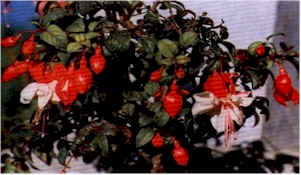
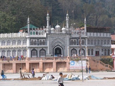
Tourism of Uttaranchal / Uttarakhand Photo:


Tourism of Uttaranchal / Uttarakhand, Uttaranchal, Uttaranchal / Uttarakhand Tourism, Adventure Trekking Tour Uttaranchal India, Flora and Fauna of Uttaranchal / Uttarakhand, Trekking In Uttaranchal, Uttaranchal Pilgrimage Tour, Adventure Tour Uttaranchal, Glaciers Of Uttaranchal, Uttaranchal Hill Stations, Hill Stations in Uttarakhand / Uttaranchal, Trekking Routes Of Uttarakhand, Adventure Activity in Uttaranchal / Uttarakhand, Hotels In Uttranchaland more

J8FP39SJ3496

Visit Nainital | Nainital Tourism

Visit Nainital | Nainital


Visit Nainital | Nainital Tourism
Nainital is a town in the Indian state of Uttarakhand and headquarters of Nainital district in the Kumaon foothills of the outer Himalayas. Situated at an altitude of 1,938 metres (6,358 feet) above sea level, Nainital is set in a valley containing a pear-shaped lake, approximately two miles in circumference, and surrounded by mountains, of which the highest are Naina (2,615 m (8,579 ft)) on the north, Deopatha (2,438 m (7,999 ft)) on the west, and Ayarpatha (2,278 m (7,474 ft)) on the south. From the tops of the higher peaks, "magnificent views can be obtained of the vast plain to the south, or of the mass of tangled ridges lying north, bounded by the great snowy range which forms the central axis of the Himalayas."

How to reach Nainital:


Nainital is well connected with the rest part of country through different modes of transport.

By Railways:

Kathgodam(35 Kms.) away is the last terminus of broad gauze line of North East Railways connecting Nainital with Delhi,Dehradun & Howarah . Haldwani(40 Kms.) & Lalkuwan(56 Kms.) are other railway terminals.

Ranikhet express departs from Old Delhi railway station at 10:45 PM daily , it reaches Kathgodam at 6:05 AM . Extra coaches for Ramnagar are attached with this train , arriving Ramnagar at 5:00 A.M. . Uttaranchal Sampark Kranti Express is also running between Kathgodam & Delhi, it start from Kathgodam at 8:50 AM in the morning and reaches Delhi at 3:20 PM and on the same day return from Delhi at 4:00 PM and reaches Kathgodam at 10:45 PM. Another special train Kathgodam Anand Vihar AC EXP runs between Kathgodam & Anand Vihar Terminal Delhi, it starts from Anand Vihar,Delhi at 06:00 AM and reaches Kathgodam at 11:55 AM and on the same day returns from Kathgodam at 3:45 PM & reaches Anand Vihar,Delhi at 09:55 PM.

Bagh Express connects Kathgodam directly to Howarah via Lucknow. Lalkua Junction 56 Kms. from Nainital is another terminal point of meter gauze line of North East Railways . Nainital Express connects Lalkua with Lucknow while Kumaun Express connects Lalkua with Mathura via Bareilly. Ramnagar 65 Kms away acts as an alternative outlet for Delhi & Lucknow.

Train Kathgodam Dehradun Express runs daily in between Kathgodam and Dehradun via Moradabad.
A new weekly train Garib Rath introduced between Kathgodam and Jammu Tawi. This train runs from Kathgodam on Tuesday & from Jammu Tawi on Sunday.

Tourist coming by rail mode can take Taxi or Buses from Kathgodam or Haldwani . Taxis are available on shared seat basis at Haldwani Taxi stand & as well as at Kathgodam & Lalkuwan railway stations. While most of the buses starts from Haldwani roadways bus stand.
Computerized railway reservation counter is situated near Bus Stand at Nainital . This facility is also available at Kathgodam, Haldwani & Lalkuwan railway stations.

By Road:

Nainital is connected to National Highway No. 87. Regular roadways buses run from Delhi, Agra, Dehradun, Haridwar, Lucknow, Kanpur & Bareilly daily . Beside this luxury coaches are available from Delhi for this place.

Distances of some nearby cities from Nainital are as follows.


Almora
64
Pithoragarh
186
Ranikhet
62
Champawat
160
Kausani
117
Kathgodam
34
Haldwani
40
Lalkua
60
Ramnagar
65
Bareilly
140
Lucknow
400
Agra
403
Delhi
310
Dehradun
300
Haridwar
245
Badrinath
334

Traffic Rules On the Mall Road:


Entry of heavy traffic is prohibited during the months of May , June and October from 8 AM to 10.30 AM and 2.30 PM to 10.30 PM , light vehicles from 6.00 PM to 10.00 PM and cycle rickshaw from 6.00 PM to 9.00 PM.

By Air:

Pantnagar 70 Kms from Nainital is the nearest air port .

Geography of Nainital:


Nainital is located at 29°23′N 79°27′E / 29.38°N 79.45°E. It has an average elevation of 2,084 metres (6,837 feet).

Climate of Nainital:


Nainital has temperate summers, maximum temperature 27 °C (81 °F); minimum temperature 7 °C (45 °F), during which its population increases more than fivefold with an annual influx of tourists predominantly from the plains of Northern India. In the winter, Nainital receives snowfall between December and February with the temperatures varying between a maximum of 15 °C (59 °F) and a minimum of −3 °C (26.6 °F).

Weather Forecast in Nainital:


Visit Nainital:


Nainital Lake:


The nucleus of Nainital’s exquisite beauty is beautiful lake .In the day, mirrored in its waters stand seven proud hills,dotted with pretty cottages and villas . This reflection alone holds one spell bound. More beautiful than this however is the lake at night when the myriads of bulbs from the hill sides and quite a large number hanging near the lake’s edge stab their magic light into its waters.

The lake offers the holiday makers ample opportunity for yachting, boating or paddling the boat. Boating rates in conventional rowing boats ranges from Rs. 30/- to Rs. 50/- in peak season days from one end of lake to another end. Paddling boats are available on hourly rate from Rs. 50/- to Rs. 90/- depending on type of paddle boat and tourist rush. Rowing as well as paddling boats are available at both ends of lake.

The north end of lake is called Mallital while the southern one is called Tallital which have a bridge (Danth popularly named) having Gandhiji's statue and post office on its sides .It is the only Post Office on the lake bridge in whole of the world.There is Bus Station , Taxi stand and Railway reservation counter on the same lake bridge , both ends have well laid out shopping centres,with beautifully laid of marts ,stores and luxury shops.

The Flatts:


At the northern side of the lake there is a place of rendezvous for people from all walks of life . Here evenings are heavily crowded. There is a statue of Pt. Govind Ballabh Pant and a beautiful fountain . There is a band stand . The Flats has playing ground used for sports games and cultural activities during festivals. There is Chat Bazar,Bhotia Market in the flats. In Bhotia Market vendors sell their fancy items .There is Mosque,Gurudwara and Naina Devi temple in flatts.Capitol cinema and Rink theatre which is used for roller skating are also situated in Flatts.A portion of the flatts is used for car parking .New club, Boat House club, Masonic Hall are in the periphery of the flatts for recreation.

Zoo:


Leopard at Nainital Zoo.Around one Km. away from bus stand at an altitude of 2100 meters in sprawling open area there is Govind Ballabh Pant High Altitude Zoo . Now a days it has Monkeys, Himalayan black bear, Leopard, Siberian Tiger, Palm civet cat, Wolf, Silver Pheasants, Siberian Tiger at Nainital Zoo Rose ringed Prakeet, Hill Fox, Ghoral, Barking Deer, Sambhar. The zoo remains closed for visitors on Monday, all national holidays , Holi & Diwali.

Aerial Ropeway:


Rope WayIt is one of the main attractions of Nainital. This ropeway connects Snow-View Point (at 2270 Mts.) with Nainital near flats. Aerial ropeway starts at Mallital , there are two trolleys to carry passengers .It takes approx. 151.7 seconds to cover one way journey by trolley. Cabin capacity is 10+1 or 825 kg.

Governor’s House (Raj Bhavan):


Raj Bhavan was built by British as residence of Governor of North West Province. Now Raj Bhavan is the official accommodation of Governor (Uttaranchal).State guests coming to Nainital also use it for their stay. It consists of a marvelous garden, Golf Links, Swimming Pool.Jhandidhar Modi Heights,Munshi heights are the other places in the complex worth seeing .The Governor’s House was built in the line of Buckingham Palace having double storied 113 rooms .For visiting this place prior permission is must.

Horse Riding:


Horse riding is another important attraction for tourists in Nainital. Horses can be hired at Barapatthar. Several tourist use horses as their transport mode to visit the different peaks of Nainital.Horse Riding is now strictly prohibitted inside the Nainital town.

Caves Garden:


This feature is the latest addition in the list of numerous tourism spots in Nainital. It is located in Sukha Tal around one Km from Mallital very near to Kumaun University Campus.

Hanuman Garhi:


Hanuman Garhi Temple It is around 3.5 Kms away from the bus stop at an altitude of 1951 Mts. Hanuman Garhi is a religious centre and famous for its sun set view .One can go to Hanuman Garhi by taxi, bus or even on foot from Nainital .It has a temple complex presiding deity being Lord Hanuman besides Ram and Shiva. At the instance of Neem Karoli Baba around 1950 these temples were built. On the other side of the hill there is Shitala Devi temple and Ashram of Lila Sah Bapu.

Snow View :


It is the most easily accessible hill top, height 2270 mts. and at a distance of 2.5 Km from the town. The spot is accessible through ropeway . This peak is also connected by motor able road. Snow view as the name suggests offers an indescribably beautiful and breath taking picture of the glittering snows of Himalyas. It has a temple. Tea, snacks, Photographers are available at this place.

Naina Peak or China Peak :


Naina peak is the highest peak of the town , at an altitude of 2611 mts. and at a distance of 6 Kms from the town .It commands an entrancing view of sparkling snow laden Himalayas from Bandar Punch in west to Api and Nari peaks of Nepal in the east , a full Himalayan range in one side and a birds eye view of the lake city of Nainital in its full grandeur on the other. With a pair of binoculars a good panorama of the tract surrounding Nainital is obtained . Pony or Horses can be hired to visit this peak either from Snow view or from Mallital.

Lands End :


Its altitude is 2118 mts. & it is located at about 4 Kms from the town. The best feature of this spot is that one does not have to climb much and as the name suggests one feels on reaching the area that the end of the land has really come. Needless to say the view of the neighboring hills and valley and the Khurpatal lake is exquisite from this point. One can go to Barapathar on a vehicle and then walk about one Km. up to the spot.

Dorothy Seat & Tiffin Top:


Located at a distance of 4 Kms from the town this peak is 2292 mts. above the sea level in Ayarpatta region. The road to this picnic spot crawls along the rugged hill side swaying this way & that, and than all in one breadth in hushed silence suddenly unfolds a canvas on which nature has painted this beautiful spot. Tiffin Top commands an excellent view of the Himalayas as well as the neighboring country side. Dorothy seat a memorial to an English lady painter Dorothy Kellet build by her husband an admirers after her death.

Tiffin Top & Lands end can be covered at a stretch as both spots are side by side.

Kilbury:


At an altitude of 2194 mts. and 10 Kms. from the town this place is accessible by a motor able road. There is a forest rest house for night stay. Kilbury is an ideal spot for a quiet and peaceful holiday.

Nainital Tourism:


Bhowali:


It is 1706 meters above the sea level and 11 KMs. away from Nainital.This is a road junction serving all the nearby hill stations from Nainital. Bhowali is famous for its scenic grandeur and as a hill fruit mart, Bhowali is also known for its T.B. sanatorium established in 1912

Ghorakhal:


Famous for the temple of Lord Golu worshipped by hill people and sainik school this place is at a distance of 3 Kms from Bhowali.

Sattal:


At a distance of about 23 Kms. from Nainital at an altitude of 1370 mts. Sattal is a unique, unforgettable spot having cluster of lakes placed amidst the oak forest. It is comparable with Westmoreland of England. As one approach toward Sattal first lake is old Nal Damyanti Lake. On moving ahead there is the ashram of Stanley Johns an American Missionary. Next lake is Panna or Garude lake.As we move down there is a cluster of three lakes , these lakes are Ram, Laxman and Sita lake.

Bhimtal:


It is about 22 Kms. from Nainital and 11 Kms. from Bhowali at an altitude of 1370 mts. The pride of Bhimtal is a beautiful lake which offers magnificent vistas for tourists. The lake is larger than Naini lake. Tourist enjoys here boating in lake. There is an island amid lake having beautiful aquarium . Tourist visit here by boats. The distance of island from lake shore is 91 mts.There is a 17th century Bhimeshwar temple complex along the 40 feet high dam . The local bus stand and taxi stand is situated near it. One road from Bhimtal leaves for Naukuchiatal while the another one goes to Kathgodam 21 Kms from here.

Naukuchiyatal:


It is 26 Kms from Nainital and 4 Kms from Bhimtal at 1220 mts above sea level.A pretty deep clean lake with its nine corner is a captivating site.Length of lake is 983 mts., breadth is 693 mts & depth 40.3 mts.It is within an enchanting valley offering an opportunity of angling and bird watching. There is ample scope for rowing, paddling or yachting.

Kainchi Dham:


On the Nainital - Almora Road, 9 Km from Bhowali and 17 Kms from Nainital is a modern pilgrim centre. This place has achieved recognition owing to the ashram of the famous Neem Karoli Maharaj. Kaichi is a term used for two sharp hairpin bends of the motor road in local dialect hence the name. It has no relation with scissors.

Mukteshwar:


This beautiful place is 2286 mts in altitude and 51 Kms. from Nainital. Surrounded by fruit orchards and thick coniferous forest it was developed by the Britishers as research and education institute (IVRI) in 1893. It is the celebrated scenic spot overlooking long ranges of Himalaya.An old temple of Lord Shiva exist on the top of a rock.

Ranikhet:


A hill station, idyllic in its charm, Ranikhet with its majestic pine trees, is 60 Kms. from Nainital. According to popular belief this spot had won the heart of Rani Padmini, queen of Raja Sudhardev . She chose this scenic place to her abode & since then, it has come to be known as Ranikhet, literally "Queen’s Field" . At an altitude of 1829 mts. above sea level, this hill station is undoubtedly a tourist’s paradise. The scented mountain breeze, fresh & pure, the singing of birds, the panoramic view of the Himalayas, the sights, sounds and smells leave the onlooker spellbound. Weaving an instant spell on the visitor Ranikhet draws visitors all the year round. You can know about Ranikhet Hill Station at http://tourismofuttaranchal.blogspot.com/2011/03/ranikhet-ranikhet-hill-station-ranikhet.html.

Kausani:


Nestling among thick dense pine forests, atop a narrow ridge and separated from the towering mountains of the Nanda Devi range by low, medium mountains ; at Kausani the grandeor of the Himalayan scenery comes alive. The view of the snow covered Trishul & Nanda Devi is so clear that one gets a feeling of the snown being within touching distance. Its ethereal sunrise & a 300 kms. wide view of the Himalayan range have attracted thousands of visitors to this place time & again. Eulogised by poets & philosophers, this scenic & beautiful spot offers so much all the year round, sightseeing, history, pilgrimage and complete relaxation .Mahatma Gandhi, who spent 12 days in 1929 at Kausani, penned his memorable commentry on the Geeta-Anashakti-Yoga inspired by the scenic grandeur of this richly gifted spot. The guest house where the Mahatma stayed is now known as the Anashakti Ashram. Hindi poet laureate Sumitra Nandan Pant was born at Kausani. Some of his early poem composed here have described nature in its myriad manifestations. Kausani is ideal for those who seek to escape from the din & dust, hustle & bustle of big cities and wish to spent a quiet holidays in the lap of nature.

Baijnath:


Situated at an elevation of 1125 mts. it is 19 Kms. from Kausani towards Bageshwar. Lying on the banks of Gomti river in a flat valley, the temple complex of Baijnath was constructed by the Katyuri kings. Here in Baijnath old anicient temples of Shiva, Ganesh, Parvati, Chandika, Kuber, Surya, Brahama are located . These were constructed in 13th century AD.

Jageshwar:


Counted among the 12 Jyotirlings in the country, Jageshwar lies in a beautiful narrow valley hedged by monarch-sized, ancient deodars. Of the over 100 small and large shrines of this complex, the three outstanding ones, in terms of sculpture, are dedicated of Jageshwar, Mrityunjaya and Pushtidevi. Jageshwar temple has sculpted dwarpals standing guard at its entrance . Although the presiding deity at Jageshwar is shiva a strong Buddhist influence is visible in the carvings. It is about 100 Kms. from Nainital.

Binsar:


95 kms. from Nainital , Binsar is one of the most scenic spot in the Kumoun Himalayas and acclaimed hill resorts. At an elevation of 2412 mts, this place offers an excellent view of Kumoun hills and the greater Himalayas , surrounded by Alpine flora, ferns, hanging moss & species of wild flowers. The main attaraction of Binsar is the majestic view of the Himalayas. A three hundred kms. stretch of famous peaks which includes Kedranath, Chaukhamba, Trishul, Nandadevi, Nandakot & Pachachuli. The forests of Himalayan Oak and rhobodendron are excellent for trekking and communing with nature.

Demographics:


As of the 2001 Indian census, Nainital had a population of 38,559. Males constitute 54% of the population and females 46%. Nainital has an average literacy rate of 91%, higher than the national average of 59.5%: male literacy is 98%, and female literacy is 86%. In Nainital, 1% of the population is under 6 years of age. Kumaonies form the major part of the town's population along with people from all over India.

Nainital in Mythology:


It is believed that Nainital figures in some ancient myths of India. In the Manas Khand of the Skand Puranas, Nainital Lake is called Tri-Rishi-Sarovar, hinting at the story of three sages (or rishis), Atri, Pulastya and Pulaha, who, upon finding no water in Nainital, dug a large hole at the location of the present day lake (sarovar = lake) and filled it with water from the holy lake Manasarovar in Tibet. According to lore, a dip in Naini Lake, "the lesser Manasarovar," earns merit equal to a dip in the great lake.

It is also believed that The Naini Lake is one of the 64 Shakti Peeths, or religious sites where parts of the charred body of Sati (Parvati) fell on earth while being carried by Lord Shiva. The spot where Sati's eyes (or Nain) fell, came to be called Nain-tal or lake of the eye. The goddess Shakti is worshipped at the Naina Devi Temple on the north shore of the present day lake.

Adventure & Sports in Nainital:


To sailors all over the country, the Nainital Yatch Club has been an embodiment of tradition & repository of sailing heritage. The Lake the fountain-head of yatching, has promoted through the club, the keen interest India has in the A participant at Naini Lakesport. Every year national & zonal races are held in Naini Lake. Swimming competetion are also organized in Nainital in summer months. Beside this Canoeing, Kyaking competetion are organized in Naini Lake. Canoing & Kyak Competetion at Naini Lake Parasailing facility is available near Naukuchiatal. One can experience this sky adventure in the company of experienced parasailors.In adventure sports Hotbalooning is another attraction at Nainital. Hotbalooning camps Parasailing at Naukuchiatalare organized at Sukhatal. Golf Tournaments held every year in Golf Course of Raj Bhavan. Hockey, Football, Cricket, Boxing tournaments take place in Nainital annualy in their respective seasons at Flatts. Nainital Hotbalooning mountaineering club at Nainital is pioneer in the area of mountaineering & rockclimbing training. Rock Climbing training takes place at BaraPathhar & Camels back.

Flora & Fauna in Nainital:


District Nainital is a unique district of Kumaun having tropical type, subtropical type, temperate, sub alpine and alpine zones in its lap. on one side its Tarai & Bhabhar belt contains the climate resembling with plain areas on the other the deep valleys having an elevation unto 1000 Mts. rear plants of hills as well as plains. The middle Himalayan ranges unto 2000 Mts. are temperate zones growing a number of typical temperate climate plants. The sub alpine unto 2500 Mts. grow high altitude plants an have the capacity to rear plants of alpine zones as well.

Alpine zone is referred to the land between snow line and above 2000 Mts. This is a typical high Himalayan belt. District Nainital contains all the zone except the alpine one. Pam Tree The soil structure and texture also varies from high sandy soils having 70 to 80% sand to clay soils in which the clay percentage is unto 20%. In between vast tracts possess sandy lome soils which are neither heavy nor very light.

The hilly region is covered with Sal, Pine, Oak, Buruns, Kaphal and other trees growing unto 6000 ft. along with Deodar, Surai etc. at higher altitudes. There are small tracts of cultivated lands and fruit orchards etc. in between the forests in this region.

The following important trees and bushes grow in Nainital:

Botanical Name - Common Name
Quercus incana - Oak (Banj)
Aesculus indica - Pangar
Junglans regia - Akhrot
Populous ciliata - Hill PipalBurus
Fraxinus miscrantha - Angu
Platanus orientalis - Chinar
Rubus lasiocarpus - Hisalu
Rosa moschata - Kunj
KilmoraBerberis asiatica - Kilmora
Cupressus torulosa - Surai
Rhododendron arboreum - Buruns
Cedrus Deodar - Deodar
Salix acmophylla - Weeping Willow
Pinus - Pine

The Bhabhar region has Babul,Kikar etc. in abundance besides Sal, Khair, Shisham as big trees. The Bhabhar grass and lantana form the undergrowth. These are considered to be the vegetation of dry and arid zones. Haldu is also common in Bhabhar region.

Horticulture in Nainital:


Apple orchards are found mainly in Ramgarh Mukteshwar belt . Beside this Peach, Pears, Apricot,Citrus fruits, Kafal, Strawberry, Hills Banana grown in the hilly track, Lichi of Ramnagar makes Nainital a main fruit growing district. Tea plantation work is also in progress in the slopes of Niglat & Ghorakhal.

Now a days a number of floriculture farm have mushroomed in the district due to its favorable climate for growing flowers.


  • Aquatic Macrophytic Vegetation
  • Potomageton pectinatus
  • Potomageton crispus
  • Polygonum glabrum
  • Polygonum amphibium
  • Polygonum hydropiper
  • Hydrilla verticellata


Medicinal Flora of District Nainital:


In its Tarai & Bhabhar belt a number of medicinal trees, shrubs and herbs grow like Vijayasar, Arjun, Bhilwa, Varun, Gambhari, Kutuj, Tejpatra, Priyangoo, Danti, Sarivah, Shwet Sarivah, Brahmi, Satwahi, Patha, Bhringraj, Punarnava, Kamal & Kamalni, Gokhru, Anatmool, Marodfali, Talwarfali, Ashok, Kaliyali, Pipli, various species of Mentha and so on. There is potential to grow Mulhatti, Aswagandha, Saptaparna and so many other plants of various zones of India.

These plants can also grow in the deep valleys of hills. In the middle Himalayan range we find CholaiDaruharidra, Timoor, Manjishtha, Sugandhabala, Samayava, Manduparna, Dhooplakkar, Talish, Devdaru, Padam, Vidhangabhed, Kakoli, Ksheerkakoli, Lahsuniya and so many other plants. This range has the potential to grow plants like Saffron, Vindhanga, Ghritkumari and so on.

The sub alpine zone of this district grows Fern, Deodar , various other species of Daruharidra, Sugandhabala, Banapsa. It has the potential to grow plants like Gandhanarain, Kutki, Kooth, Bhootkesi, Junipers, Abies which is called Fern . Here around 2500 mts. plants like Jatamasi, Mithavish, Atish can also be tried.

Many of these plants have a great commercial importance. These are widely used in indigenous system Fusiaof medicines like Ayurveda, Yunani, Aamchi (Tibetan System) for skin diseases, stomach disorder, nervous disability, liver diseases. Many of these are used in heart & brain tonics. Some are blood purifiers and strengthen the immunity mechanism.

At present crores of this herbal raw material is supplied to Haldwani, Ramnagar, Dehradun & other mandis of plains. Bheshaj Sanghs & K.M.V.N. has the official authority to collect these medicines.

Animals at Nainital:


deerPresbytis schistaceous (Himalayan Langoor) , Invus rhesus (Monkey),Urssus Tibetans (Rich),Martes flavigula (Black capped Marten), Hysrix leucura (Indian Porcupine) ,Sus Indicus (Wild pig) ,Cervulus aurens (Barking deer) , Pteromys petaurista (Brown flying squirrel) , Nemorhoedus goral (Gural).

Birds at Nainital:


Corvus macrohynchoes (Jungle crow), Corvus splendens (house crow), Parus monticolus (green backed tit), Trochalopteron lineatrum (Streaked laughing Thrush), Turdus boulboul (Grey Winged Black Bird), Passer domesticus (House Sparrow),Certhia himaayana (The Himalayan Tree Creeper), Acridotheres tristis (Common Myna), Pericrocotus brevirostris(short billed minivet).

Fishes in the lakes of Nainital:


The fishes belong to one group commonly known as carps. Generally cat fishes are not found in the lake. Among carps both major and minor fishes are present in the lake. The major fishes have three important classes, Mahaseer the so called hill trout and the mirror carp.

Mahaseer:


Mahaseer Two species of this fish are found in the region .

Tor tor: The red finned mahaseer.

Tor putitora : The yellow finned Mahaseer. It is highly valued as a food fish, and normally grows to a large size from 20 to 60 Cms.

Hill Trout:


Commonly known as Asela or Rasela. This fish comprises three species.


  • Schizothorax sinuatus
  • Schizothorax richardsoni
  • Schizothorax plagiostornus


Mirror Carp:


Cyprinus carpis, it has been imported and is bred on a large scale in Nainital.

The common carp fishes such as mahaseer and hill trout have been found to breed several times

during one spawning season from May to September.

History Nainital:


Early Construction in Nainital:


The Kumaon Hills came under British rule after the Anglo-Nepalese War (1814–16), but the hill station town of Naini Tal was founded only in 1841, with the construction of the first European house (Pilgrim Lodge) by P. Barron, a sugar trader from Shahjahanpur. In his memoir, he wrote: "It is by far the best site I have witnessed in the course of a 1,500 miles (2,414 kilometres) trek in the Himalayas." In 1846, when a Captain Madden of the Bengal Artillery visited Naini Tal, he recorded that "houses were rapidly springing up in most parts of the settlement: some towards the crest of the limitary ranges were nearly 7,500 ft (2,286 m) above sea level: the rugged and woody Anyarpatta (Anyar-patt - in Kumaoni means - complete blackout. The reason for this nomenclature by the localites was because there were minimal sun rays due to its location and dense forests) was being gradually planted and that the favourite sites were on the undulating tract of forest land which stretched back from the head of the lake to the base of China and Deopatta (Camel's Hump). The Church, St. John in the Wilderness, had been built, ..." Soon, the town became a health resort favoured both by British soldiers and by colonial officials and their families trying to escape the heat of the plains. Later, the town also became the summer residence of the Governor of the United Provinces.

The Landslip of 1880:


In September 1880 a landslide (the Landslip of 1880) occurred at the north end of the town, burying 151 people. The first known landslide had occurred in 1866, and in 1879 there was a larger one at the same spot, Alma Hill, but "the great slip occurred in the following year, on Saturday 18 September 1880." "Two days preceding the slip there was heavy rain, ... 20 inches (508 millimetres) to 35 in (889 mm) fell during the 40 hours ending on Saturday morning, and the downpour still lasted and continued for hours after the slip. This heavy fall naturally brought down streams of water from the hill side, some endangering the Victoria Hotel, ... (which) was not the only building threatened ... Bell's shop, the Volunteer Orderly Room and the Hindu (Naina Devi) temple were scenes of labour with a view to diverting streams. At a quarter to two the landslip occurred burying those in and around the buildings mentioned above." The total number of dead and missing were 108 Indian and 43 British nationals. (See poem by Hannah Battersby on the page Literary references to Nainital). The Assembly Rooms and the Naina Devi Temple were both destroyed in the disaster. A recreation area known as 'The Flats' was later built on the site and a new temple was also erected. To prevent further disasters, storm water drains were constructed and building bylaws were made stricter.

Establishment of schools:


In the latter half of the 19th century a number of "European" schools for boys and girls were founded in Nainital. During the Victorian and Edwardian eras, students in these schools consisted largely of children of British colonial officials or soldiers. In 1906, for example, there were over half a dozen such schools,[7] including the Diocesan Boys' School (later renamed Sherwood College) under the guidance of the Church of England; Philander Smith's College (now, Birla Vidya Mandir), maintained by an American; St. Joseph's College a Roman Catholic institution, Wellesley School an American institution; St. Mary's Convent High School, a Roman Catholic institution; All Saints Diocesan High School for Girls, under the Church of England, and Petersfield College for Girls.

In the 1920s and 30s, the schools began to admit more Indian students. This trend continued until independence, by which time the student bodies had become predominantly Indian, albeit in many cases greatly reduced in size.no place has comprassion with nainital its to beautiful in whole utk.you can see so lot of people who has resident at their.

Educational and Research Institutions in Nainital:


The Schools:


For well over a century, Nainital has been known for its many schools. Four schools from the British period continue to exist today: Sherwood College,[10] established 1869; All Saints' College,[11] established 1869; St. Mary's Convent High School established 1878; and St. Joseph's College established 1888. In addition, a number of new schools have been established since independence: Birla Vidya Mandir, established 1947; Sanwal School, established in the 1940s in Mallital; St. Amtuls Public School, established 1983; Parvati Prema Jagati Saraswati Vihar, established 1983; and Oakwood School, established 1989. Chait Ram Sah Thulgharya Inter College (CRST) Nainital Mallital;Bhartiya Saheed Sainik Vidhlay(BSSV) Nainital, Sainik School, established 1966, in Gorhkhal, Bhowali.

Kumaon University:


Nainital is home to one of the two campuses of Kumaon University (the other being Almora). The university was founded in 1973 when it incorporated the Dev Singh Bist (DSB) Government College (commonly called "the Degree College"), which had been founded in 1951 by Thakur Dan Singh Bist in memory of his late father, with the mathematician Dr. A.N. Singh as its first principal.

ARIES (State Observatory):


The 50-year old State Observatory at Nainital was reborn in 2004 as ARIES, the Aryabhatta Research Institute of Observational Sciences, an autonomous institute under the Department of Science and Technology, Government of India. The Observatory, which had come into existence in Varanasi in 1954, was moved the following year to Nainital, under its more transparent skies. In 1961 it was moved once again to its present location—Manora Peak (1,951 m (6,401 ft)) —a few km south of the Nainital town. ARIES's main objective is to provide national optical observing facilities for research in astronomy, astrophysics, and the atmospheric sciences.

Libraries:


There are a number of libraries in the Nainital area. Among them are the Durga Lal Shah Municipal Public Library, on the Mall, founded in 1934; the Uttarakhand Academy of Administration, Library and Documentation Center, Mallital; the ARIES Observatory Library; and the Kumaon University Library, Nainital.

Famous people with links to Nainital:


  • Elsie Inglis, physician and social reformer
  • Jim Corbett, hunter of man-eating tigers, author, conservationist and namesake of Jim Corbett National Park
  • Govind Ballabh Pant, statesman and leader of India's independence movement, first Indian Premier of British India, the first Chief Minister of Uttar Pradesh and the first Home Minister of India
  • Hastings Ismay, 1st Baron Ismay, first secretary general of NATO
  • Percy Hobart, British major general and military engineer
  • Orde Charles Wingate, British general and commander of the Chindits in Burma during World War II
  • Soham Swami, guru and yogi
  • Niralamba Swami, guru and yogi
  • Swami Sri Lilashahji Maharaj, guru and yogi, guru of Sant Sri Asaramji Bapu
  • Swami Swarupananda, first president of Advaita Ashrama and direct disciple of Swami Vivekananda
  • Sam Manekshaw, Indian Army Chief of Staff during Indo-Pakistani War of 1971
  • Som Nath Sharma, India's first Param Vir Chakra award winner
  • Narayan Dutt Tiwari, Indian leader and politician, former Governor of Andhra Pradesh, former Chief Minister of Uttarakhand and Uttar Pradesh, and former Finance Minister of India.
  • Krishna Chandra Pant, former Deputy Chairman of the Planning Commission of India
  • Rajendra K. Pachauri, chairman of the Intergovernmental Panel on Climate Change
  • Vandana Shiva, philosopher, environmental activist and eco feminist
  • Sudhir Kakar, renowned psychoanalyst
  • Anup Jalota, singer
  • Amitabh Bachchan, Bollywood actor
  • Naseeruddin Shah, Bollywood actor
  • Kabir Bedi, Bollywood Actor
  • Danny Denzongpa, Bollywood actor
  • Nirmal Pandey, Bollywood actor and singer
  • Dilip Tahil, Bollywood actor
  • Chandra 'Channi' Kumar Arora, former hockey international and coach
  • Manish Pandey, cricketer who plays for Karnataka and Bangalore
  • Lalit Modi, Indian Premier League (IPL) chairman
  • Manasvi Mamgai, Miss India World 2010
  • Dr.Devender Singh Digari (Founder) Panther State a famous resort near jylikot .
  • Nitin Kakkar (Radio Jockey BIG FM)


Hotels in Nainital / Nainital Resorts:


  • Palace Belvedere Nainital
  • Balrampur House Nainital


Heritage Hotels Of Nainital:


  • Royal Hotel Nainital
  • Fairhavens Hotel Nainital
  • Alka Lakeview Resort
  • Hotel Krishna Nainital


First Class Hotels In Nainital:


  • Shervani Hill Top Inn
  • Manu Maharani Resort
  • The Naini Retreat Nainital
  • Vikram Vintage Inn
  • Hotel Arif Castles
  • Alpine Chalet Nainital


Tourist Class Hotels In Nainital:


  • Pine Crest Nainital
  • Grand Hotel Nainital
  • Dynasty Resort Nainital
  • Hotel Everest Nainital
  • Hotel Classic The Mall
  • Swiss Hotel Nainital
  • Mountain Trail Nainital
  • The Ramgarh Bungalows Nainital
  • Cedar Lodge Nainital


Budget Hotels In Nainital:


  • Elphinestone Hotel
  • Hotel Capri Nainital
  • Hotel Channi Raja Nainital
  • Hotel City Heart Nainital
  • Hotel Earlcourt Nainital
  • Hotel Evelyn Nainital
  • Hotel Metropole Nainital
  • Hotel New Pavilion
  • Hotel Pratap Regency
  • Hotel Silverton Nainital
  • India Hotel
  • James Cooks Cabins
  • Lakeside Inn Nainital
  • Manu Maharani Lodge
  • Palace Resort Nainital
  • Welcome Resort Nainital
  • Chevron Fairhavens
  • The Ramgarh Bungalows
  • Claridges Naini Retreat
  • Classic - The Mall
  • Hotel Arif Castles
  • Jungle Lore Birding Lodge
  • Manu Maharani Lake Resort
  • Solluna Resort


Nainital photos:


Visit Nainital, Nainital Tourism, Hotels in Nainital, Nainital Weather, Nainital Lake, Nainital Map, Nainital Photos, How To Reach Nainital, Nainital